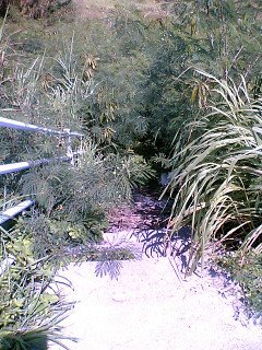
Hey! Long time no talk...again... So I'm trying this whole "tell the story backwards" thing today so you get more of an up to down plot line. I've decided, after passing one of many of these, that I would start a little segment I'd like to call, "STAIRS BRETT WILL NEVER GO DOWN!" I thought the caps was a nice touch. So, yeah...not entirely sure the purpose of these stairs, but the welcome doesn't look nice at all. Anyway, I thought it would be nice if I gave a small tour of the island and it's beaches (okay well beach, but I promise to go back to Tokashiku beach at one point). Les GO!!!

Okay, so here's a shot of the Southern part of Tokashiki island. You can juuuust make out the lighthouse, haven't made it there myself but hope to one day. I took this and the next shot on the liner (fast boat) one day when I was leaving Tokashiki for a wild night on the town in Naha (if you're nice I'll tell you about that one). The sky can be so amazing out here, when there are clouds the sun shines through brilliantly and when there aren't you get a clear view of the universe at night. I have it rough, lemme tell you.

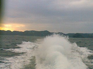
Ahh, and here's another picture of Tokashiki jima from the ferry. I took this picture more because I loved the giant geyser of water that the liner was spewing. Wow, that would be crazy to try wakeboarding on.
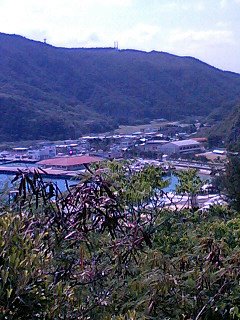
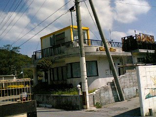
So here's the start of the actual island tour. This lovely little village is none other than Tokashiki itself. I took this shot up near an old army base turned hostel, it was about a 25 minute walk up a mountain, but I enjoyed it.

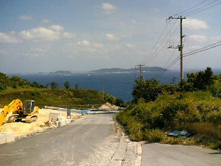
A bit further down the road from the nice view of Tokashiki you get another very nice view of Mae jima. Also, if you look reeeeeealy closely you can just make out the mainland of Okinawa, about where Naha is. See the really shady, blueish areas around and behind Mae jima? It's crazy at night because Naha is all lit up and a large contrast to Tokashiki.

So here's a slightly worse shot of Tokashiki Village. You can't get much of the front, but you can see back toward the back better, where the rice fields are. My apartment is on the left of the picture, see it? I found it! haha

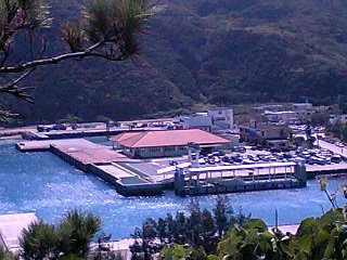
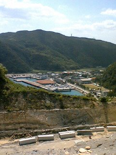
Here's a picture of Tokashiki's port from above. It's actually pretty big, but unless you look at it like this it seems small. Either way, the Liner port (more on this later) is the white thingy on the right and the big ole ferry docks on the left. Neato

Just a bit down the road from the last couple of pictures is an entranceway to a shrine. It's kind of covered in construction at the moment, but from what I understand, this shrine is a shrine for all the children who were killed or died before their time. If you're nice I may give you a small history lesson a little later on. ~.^

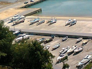
Okay, we're getting close to the bottom of the mountain and we get a good shot of the little (well, not so little) docking area for all of the boats. I know dad would love it, but there aren't really that many sail boats here. Anyway, if it seems like a lot of boats are out of the water, it's because this was taken around the time of a typhoon, and it's never smart to keep your boat in the water during a typhoon...unless you're Forrest Gump or something.

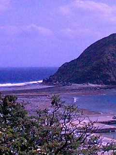
Okay, here's a picture of Ie jima at low tide. Notice the land path? You could easily walk on the dry land to get to the island, but you want to make sure you watch the time, because when high tide hits, all of that goes for a swim and you could be stuck on that little island for a few hours. Not too much fun, unless you remembered your fishing pole.

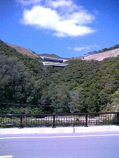
Here's a picture from about a 5 minute walk to the bottom of the Northern mountain. What a walk to get up, eh?

Finally a picture of one of my favorite places to hang out...well besides a friend's house. This is Marine Box, more commonly called Maribo (Mari from Marine and bo from Box, aren't they clever?). This is pretty much the only bar in Tokashiki, so if I want to drink elsewhere I have to walk a ways. Anyway, when they weren't understaffed they had the beer garden on top open and all the drinks were half price. Two dollars for a pint of beer or a glass full of Awamori, delicious Awamori. They do also serve real food downstairs, and drinking snacks on both floors. Oh, did I mention that the lower floor also goes karaoke every night at around 10? yeah.

So we've reached the bottom of the Northernmost mountain and boy am I tired. jk. This shot is about half of the mountain. The old army base converted into hostel is to the left of this picture and a bit farther up, but even if I had taken a picture of that area, you really couldn't see it. This building is one I've never been into. As far as I can gather, this is the pound, though it doesn't look like much. They apparently don't consider stray cats as poundworthy, since they're walking all over the place, and when they do have animals here (well okay just dogs), they lock them outside, in cages or just roped to the side of the building. Weird...

Ahh yes, here is a picture of the lovely, new dock for the speedy little liner. Apparently this was not here last year and opened up maybe a month before I got here. It really is pretty nice though, but since it's just a dock...well there's not much I can say about it...huh. Oh, we sometimes have late night eisa practices in front of it! that's something right?

So once again, we see Ie jima in all it's glory. This is the farthest South point of the port, where all the water entries are done for the many boats seen earlier. The walls there are definately needed for the typhoon season, those waves can get pretty harsh...too bad I don't have my board. The ferry and Liner enter the port at the right of the picture between Ie jima and the closer piece of land...you can't really see the opening here, but trust me, it's there.

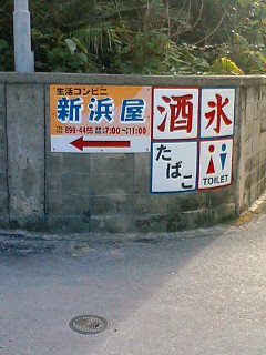
Okay, I thought this was great and felt I should share my amusement. So this is a typical type of advertisement for a convenience store, of course the ones in the city are a bit more high tech, but meh. For those of you who can't read kanji, I will explain their advertising priorities. The sign with the arrow is the store name, Nihamaya. The upper left white sign says sake or alcohol, to the right of that is mizu, water. The lower left white sign reads ta ba ko, tabacco, and the next one should be pretty understandable, toilet. Aren't their priorities great? Of course in the bigger city, when they have less space the top two are alcohol and tabacco. o.O

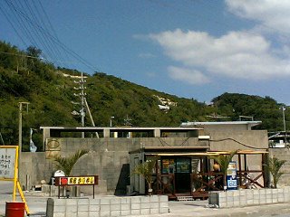
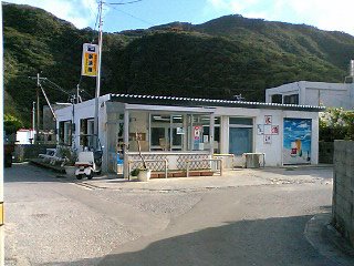
Okay, so next on the list is the very convenience store that was just advertised. This is one of maybe 4 convenience stores in Tokashiki, Nihamaya. I think I've mentioned it before, but there are no grocery stores on the island, just a bunch of convenience stores. Isn't that great? The great thing about this store is just to the right of it. On the right of the building are two white picnic tables. What are they doing there you ask? Well, they're for drinking on of course. That's right, many times after a practice, whether it's eisa, volleyball, badminton, or taiko, The group will come to the convenience store, buy themselves some drinks, come back outside and drink at the tables for hours, often until the store closes and turns its lights off. You gotta love it. p.s. Surfer Hello Kitty Rawks.

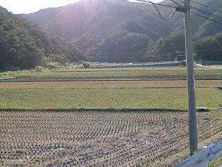
Okay, so on the walk from Tokashiki village to Aharen village you get to see not only goats, but these! Yes you guessed it, rice farms. We don't have much farming space, but what is here is definately being used. I'm still not entirely sure the whole process of growing rice, but I'm sure I'll figure it out by the time I leave. Oh and to avoid future confusion, the name of the island is Tokashiki, but on the island are three villages, one of which just so happens to also be called Tokashiki. Okay, any questions? ...no? good.
Also on the walk from Tokashiki village to Aharen village there is the smallest village of three on the island, Tokashiku. Of course you can't really see it in this shot, but it's in the lower right part of the picture. I'll get better shots later I promise, as well as shots of the southern most part of the island, where there is basically just a bathroom...it's a really nice bathroom if that helps.

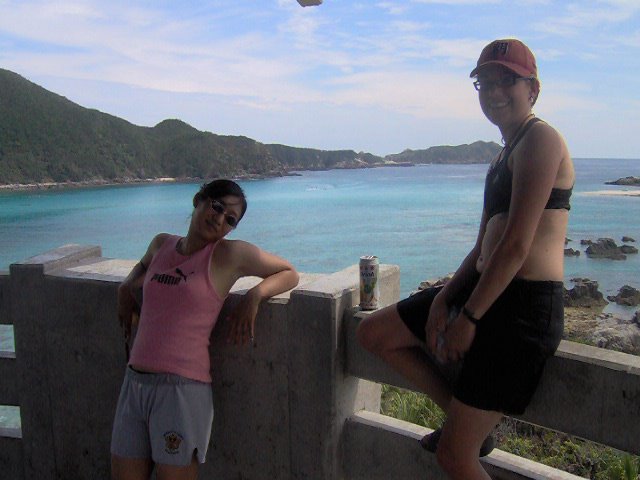
So I thought I'd make my big introduction to Aharen Beach with a couple of lovely ladies. This picture was taken very close to the beginning of my stay here, when a large group of fellow JETs came and visited Tokashiki for a weekend of fun. Of course it rained pretty much the whole second day (longest I've ever seen it rain here by the way), but I think fun was still had. Anyway, on your left is the lovely Chiye, posing all cool like, and to your right is the lovely Julie, livin life on the edge and appearing to have a good time. This pic is taken from this little, out of the way viewpoint. To get here you have to do a bit of walking up a semi-steep path filled with bugs and hot, but the moment you get to the top of the stairs and enter the viewpoint, it was all worth it. You are almost immediately struck by a cooling breeze, since you are pretty high up, and then are struck again by the amazing view of Aharen and the surrounding ocean. This is one of my favorite places to go and relax. Just thinking of it makes me want to go there again, but then that would be a bit of a walk...over a mountain...okay, I'm over it haha.

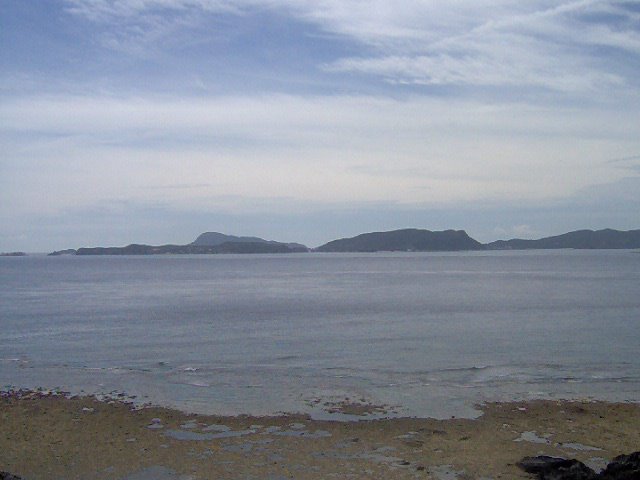
So here's a view of Aharen taken a while back. If you couldn't tell, it is about to rain, and the odd thing is that there are still little to no waves. I'll explain this later, but in this view you can see Tokashiki's next door neighbor Zamami island! Wave, they get lonely. Zamami is apparently actually composed of three large islands connected by giant bridges. I haven't been there myself, but you can easily see the bridges even from Tokahiki, and if you look closely at the picture you may see one for yourself. Needless to say, Zamami is much more populated than Tokashiki's 500. ^^

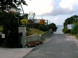
So I promised I'd put it in and I am. To the left you will see the entrance to Aharen Elementary. Straight, you see...ocean. Oh so difficult to choose. Of course, I choose the job, but don't worry, I make sure to hit the beach after work every week. haha

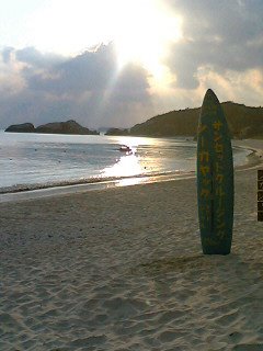
I thought I'd throw this in now, but this last week, Thursday actually, we had a wakeboarding practice and one of the members decided it would be fun to write out "wake riders" with pieces of coral. Of course I corrected their spelling, but not until I got a shot of it first. I added a little face afterwards with random shells I found on the beach. o('.')b
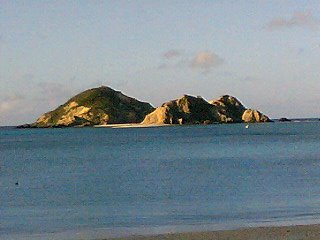
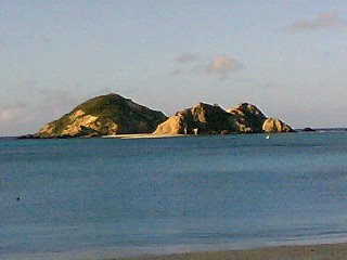
So as you come onto Aharen beach from the school entry...well any entry really, but this was from the school one...you will get a good sight of this island. I forget it's name, but it's at about the 1/3rd point from Aharen beach to our neighboring island, Zamami jima. I'm told that before all of the boats were powered and dangerous, people would swim from the beach to that island daily for exercise. Makes sense...it's only about 800 meters away, probably good exercise. I was also told that once a year the students of Aharen swim the whole thing. Guess who's going to make sure they're going to be there for the next one. Oh, by the way, that little white spot on the right side of the island is a boat if you were wondering. ^^

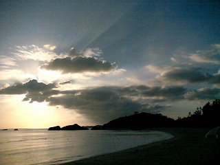
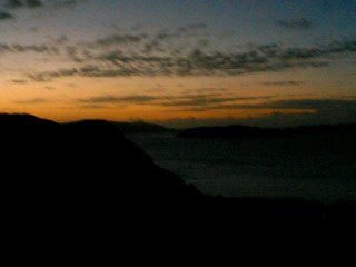
Here's my second favorite picture of Aharen beach, taken just this last week. The sun behind the clouds was so breathtaking that I had to risk getting my phone wet (I had been wakeboarding all day, and yes I have a bit of a sunburn). The ocean at Aharen beach is almost always that calm sometimes even calmer. This is because it is caught in kind of a big bowl between Tokashiki island and Zamami island, our neighboring island.

Okay, so we'll finish up the day with my favorite shot of Aharen beach. This is the wallpaper on my phone and it pretty much sums up life at Aharen. Calm waves lapping at the beach as the sun sets behind very fluffy clouds. Isn't life rough?